The Alpine Lakes That Turn Impossible Colors
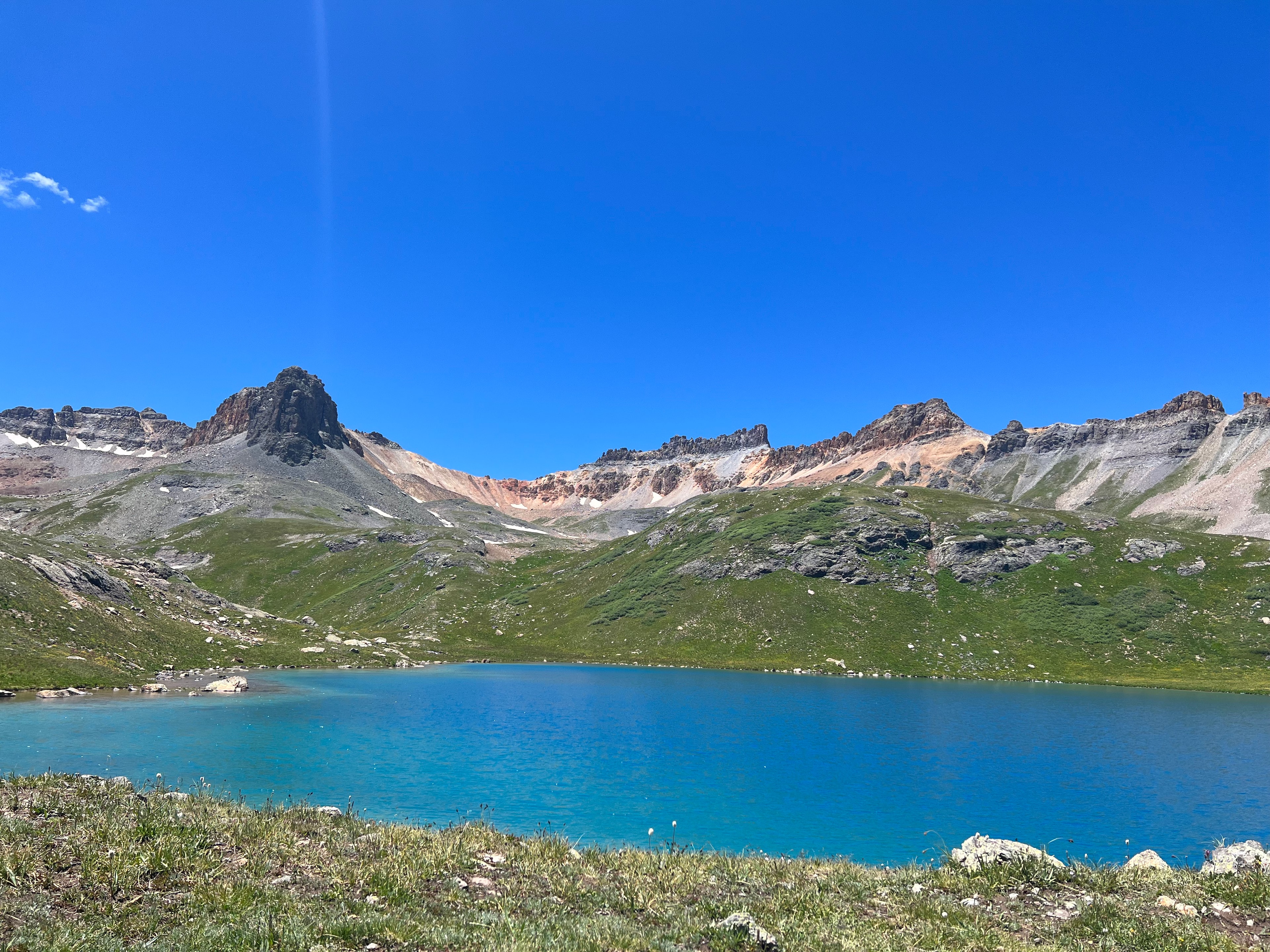
The first time I saw Ice Lake, I thought my eyes were lying. I'd been climbing for two hours through spruce forest and wildflower meadows, sweat-soaked and breathing hard at 12,000 feet, when the trail crested a rocky lip and the basin opened below. The water was turquoise. Not the polite, postcard turquoise of a Caribbean resort pool, but an electric, almost radioactive blue-green that looked like someone had dumped a thousand gallons of paint into a granite bowl and let the sun do the rest.
It wasn't paint, of course. It was glacial rock flour -- particles of stone ground so fine by ancient ice that they stay suspended in the water column, scattering light in wavelengths that shouldn't exist at 12,000 feet in Colorado. And Ice Lake is just one of them. The San Juan Mountains hold dozens of alpine lakes above treeline, each carved by glaciers that retreated ten thousand years ago, each with its own particular shade of impossible.
Here are four basins worth losing your breath over.
Ice Lakes Basin
Trailhead: South Mineral Creek (off US-550, about 45 minutes from the Purgatory area) Distance: 8.4 miles round trip to Ice Lake; 9.8 miles if you continue to Island Lake Elevation: 12,270 feet (Ice Lake) / 12,392 feet (Island Lake) Gain: ~2,500 feet
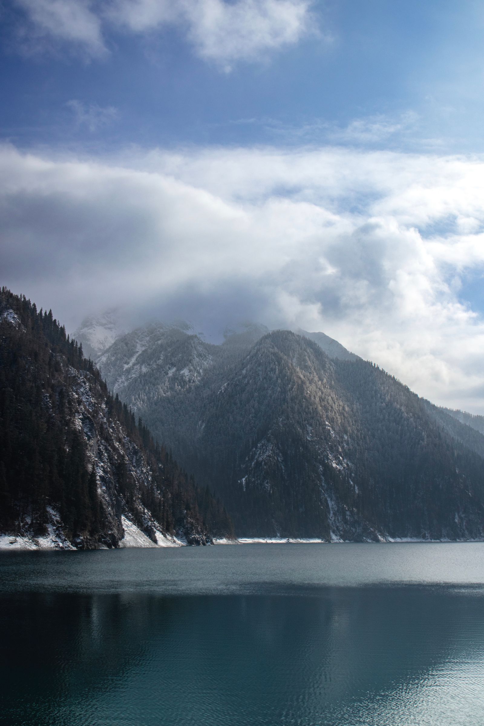
This is the one that ends up on everyone's screensaver, and for good reason. The trail starts at South Mineral Creek and wastes no time -- you're climbing from the first step, switchbacking through dense forest before emerging into the lower basin around mile two. This is where most people stop to catch their breath, and honestly, you could spend all day here and not regret it. In late July and early August, the lower meadows erupt with Colorado blue columbine, scarlet paintbrush, and old-man-of-the-mountain -- the oversized alpine sunflower that always faces east, like it can't stop watching the sunrise.
But keep going. The trail steepens through talus and scree, and then you're standing at the edge of Ice Lake, and the color hits you. The turquoise is so saturated it almost vibrates. On a still morning, the surrounding 13,000-foot ridgeline reflects in the surface with mirror precision.
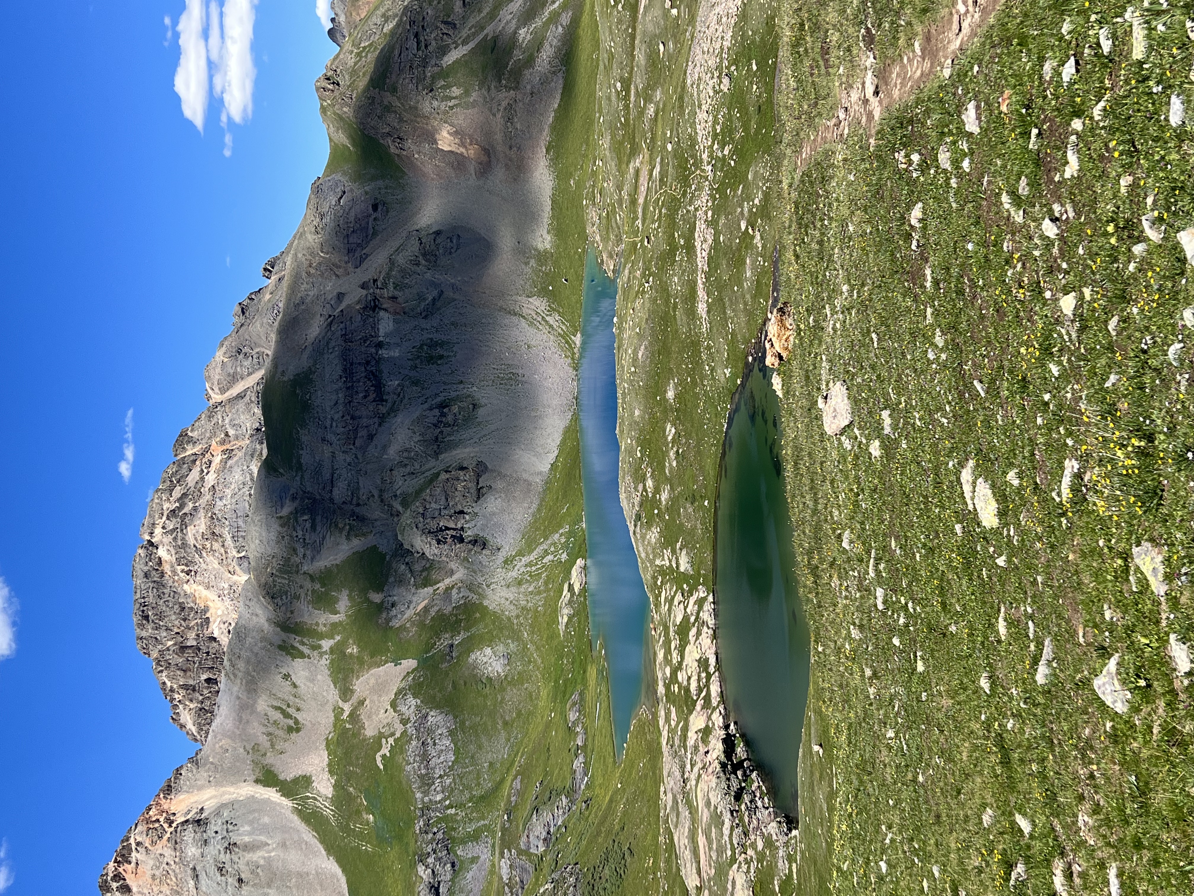
If you have the legs for it, push another 0.7 miles and 120 vertical feet to Island Lake at 12,392 feet. It sits in an even more dramatic cirque -- a crystal-clear tarn with a small rocky island breaking its surface, ringed by jagged peaks on three sides. The reflection photography here is world-class. Bring a wide-angle lens and a tripod, and arrive before 10 a.m. when the wind picks up.
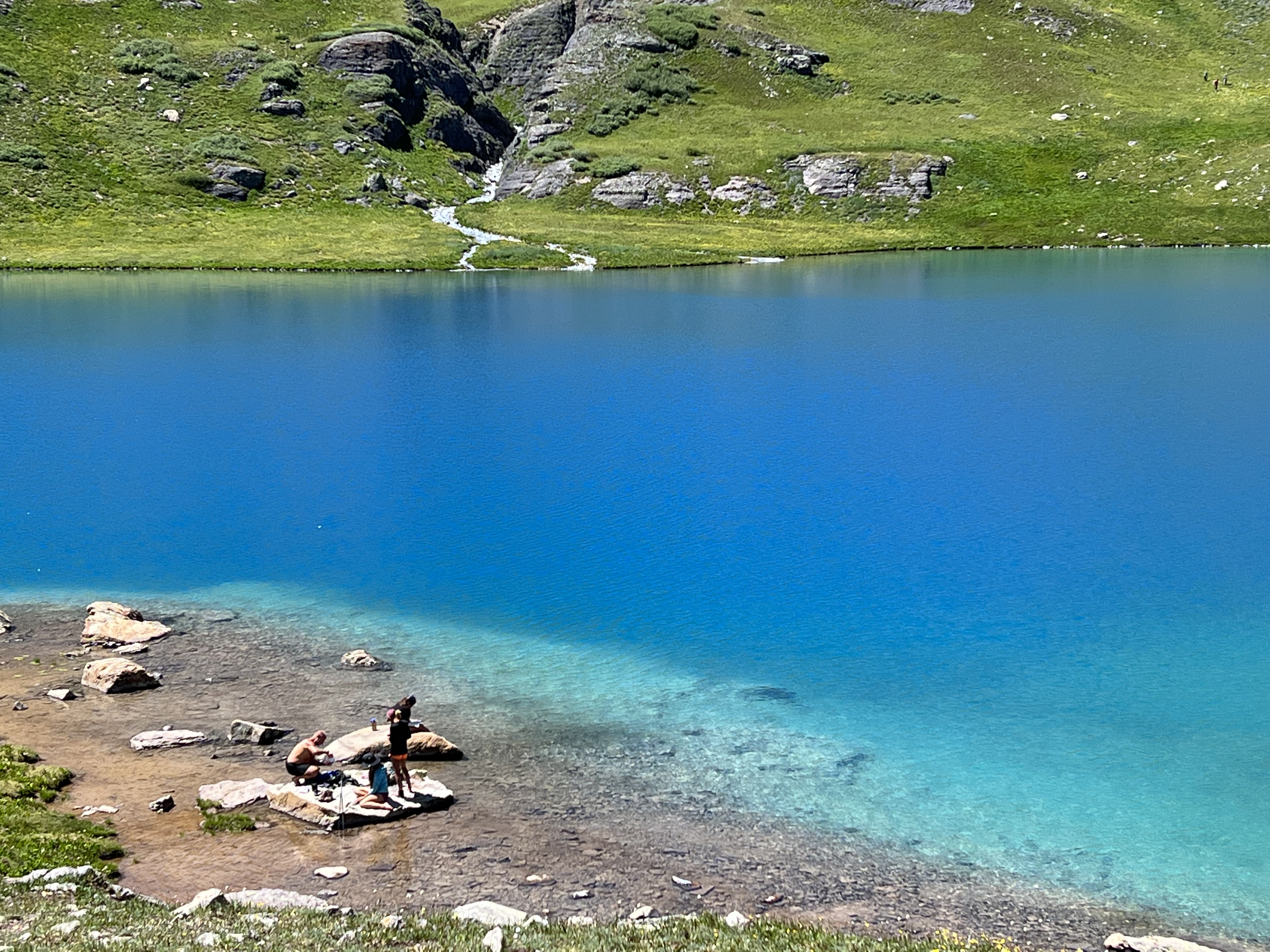
Water temperature: Don't let anyone dare you. Even in August, these lakes hover in the low 40s. A quick dip is a rite of passage. A long swim is hypothermia.
Blue Lakes (Mt. Sneffels Wilderness)
Trailhead: Blue Lakes trailhead, off Dallas Creek Road near Ridgway (about 1 hour 45 minutes from Purgatory via US-550) Distance: 7.4 miles round trip to the upper lake Elevation: 11,000 feet (Lower Blue Lake) up to 12,850 feet (Upper Blue Lake) Gain: ~2,800 feet
Blue Lakes is a different kind of spectacle. Where Ice Lake is turquoise, the Blue Lakes are cobalt -- a deep, dark, almost oceanic blue that seems to absorb light rather than reflect it. Three lakes are stacked vertically in a glacial cirque directly beneath the north face of 14,150-foot Mt. Sneffels, one of Colorado's most rugged fourteeners. The mountain looms over the upper basin like a broken cathedral, its summit often ringed with clouds even on clear days.
The approach is dramatic. The trail climbs steeply through aspen groves and subalpine meadows before reaching the first lake. The lower lake is the largest and most accessible, but the real payoff is scrambling up to the middle and upper lakes, where the scale of the cirque walls becomes genuinely humbling. Standing at the upper lake, you're in a granite amphitheater with 2,000-foot walls rising on three sides and nothing but sky above.
This hike is harder to reach from the Durango/Purgatory area -- it's a longer drive north through Silverton and over Red Mountain Pass on US-550, or around through Ridgway. But the effort filters out the crowds, and on a weekday in September, you might have the entire basin to yourself.
Highland Mary Lakes
Trailhead: Cunningham Gulch Road, near Silverton (about 1 hour 15 minutes from Purgatory) Distance: 7.0 miles round trip Elevation: ~12,200 feet Gain: ~1,800 feet
If you want alpine lakes without the parade of Instagram hikers, Highland Mary is your answer. Accessed from Cunningham Gulch near Silverton -- the same road where nineteenth-century miners hauled silver ore by mule train -- this trail passes through some of the densest mining history in the San Juans before opening into a wide, lake-studded basin that feels genuinely remote.
The hike passes ruined mine structures and tailings piles that have been slowly dissolving back into the mountain for a century. There's something about walking past a collapsed stamp mill at 11,800 feet, rusted cables still strung between rotting timbers, and then rounding a corner into a pristine alpine basin with four separate lakes reflecting the sky. The contrast between human ambition and geological indifference is striking enough to make you stand still for a minute.
The lakes themselves are classic alpine tarns -- clear, cold, rimmed with tundra grass and krummholz. The colors here tend toward steel blue and silver-green, more subtle than Ice Lake's turquoise but no less beautiful, especially in the soft light of early morning or late afternoon. Photographers love this basin because the lower crowds mean you can shoot without waiting for people to clear your frame.
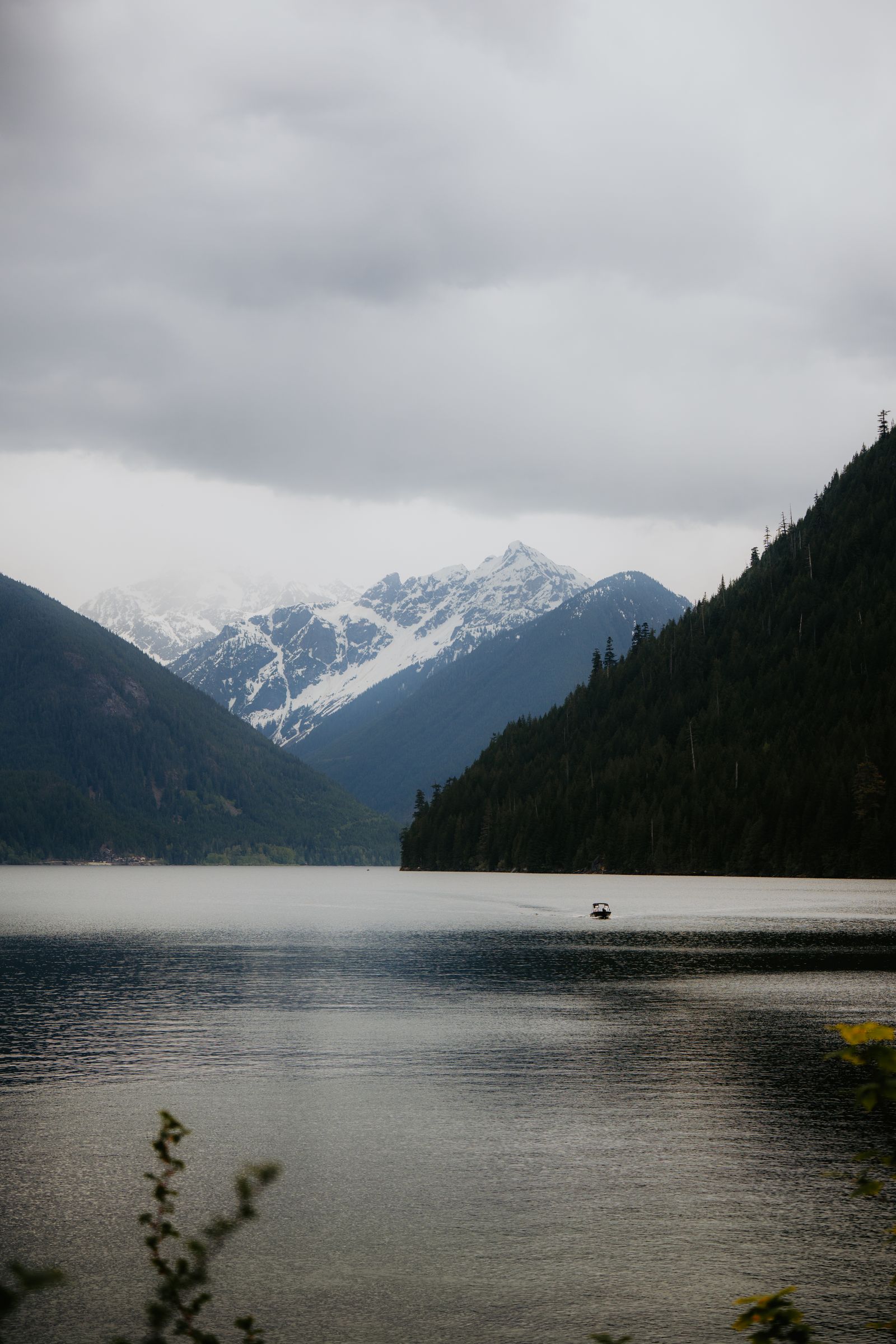
Crater Lake (Weminuche Wilderness)
Trailhead: Andrews Lake, off Molas Pass on US-550 (about 30 minutes from Purgatory) Distance: 5.4 miles round trip Elevation: ~11,800 feet Gain: ~1,200 feet
Crater Lake is the most accessible of these four and makes an excellent introduction to San Juan alpine lakes if you're not ready for a 2,500-foot climb. The trailhead sits right off Molas Pass on US-550, and the hike itself is moderate -- rolling through spruce-fir forest with a steady but manageable grade.
The destination justifies everything. Crater Lake sits in a dramatic cirque with the spires of the Grenadier Range -- part of the Needle Mountains -- visible to the south. These are some of the most rugged peaks in Colorado, remote enough that most of them see fewer than a dozen ascents per year. You won't be climbing them on a day hike, but seeing their silhouettes from Crater Lake's shore gives you a sense of how much wilderness surrounds you. The Weminuche, at 500,000 acres, is Colorado's largest wilderness area, and from this lake you can feel every acre of it.
The lake is also a popular jumping-off point for backpackers heading deeper into the Weminuche via the Continental Divide Trail, so you'll often meet people with heavy packs and thousand-yard stares who've been out for a week. Buy them a beer when you get back to town. They've earned it.
Before You Go: What You Need to Know
Season: Mid-July through mid-September is the window. Before that, snow covers the trails above 11,000 feet. After that, early storms can make conditions unpredictable. Late July to mid-August is peak wildflower season and the most reliable weather.
The thunderstorm rule: This is not optional. Afternoon thunderstorms build almost daily in the San Juans during summer, and above treeline you are the tallest thing on the landscape. Plan to be at your high point by 11 a.m. and heading down by noon. Start early -- 6 or 7 a.m. trailhead departures are standard, not heroic. Lightning above 12,000 feet is genuinely dangerous.
What to bring: Layers. Always layers. A sunny 65-degree morning at the trailhead can become a 38-degree sleet storm at the lake by early afternoon. Pack a rain shell, a warm mid-layer, sun protection, and more water than you think you need. Altitude dehydrates you faster than you realize, especially if you're coming from lower elevations. Trekking poles help significantly on the steep, rocky descents.
Altitude: If you're arriving from sea level or anywhere below 5,000 feet, give yourself a day or two to acclimatize before attempting these hikes. Headaches, shortness of breath, and nausea are common above 10,000 feet if you haven't adjusted. Drink water relentlessly. Skip the wine the night before.
Drive times from the Purgatory area: - Crater Lake (Andrews Lake trailhead): ~30 minutes - Ice Lakes Basin (South Mineral Creek): ~45 minutes - Highland Mary Lakes (Cunningham Gulch): ~1 hour 15 minutes - Blue Lakes (via Ridgway): ~1 hour 45 minutes
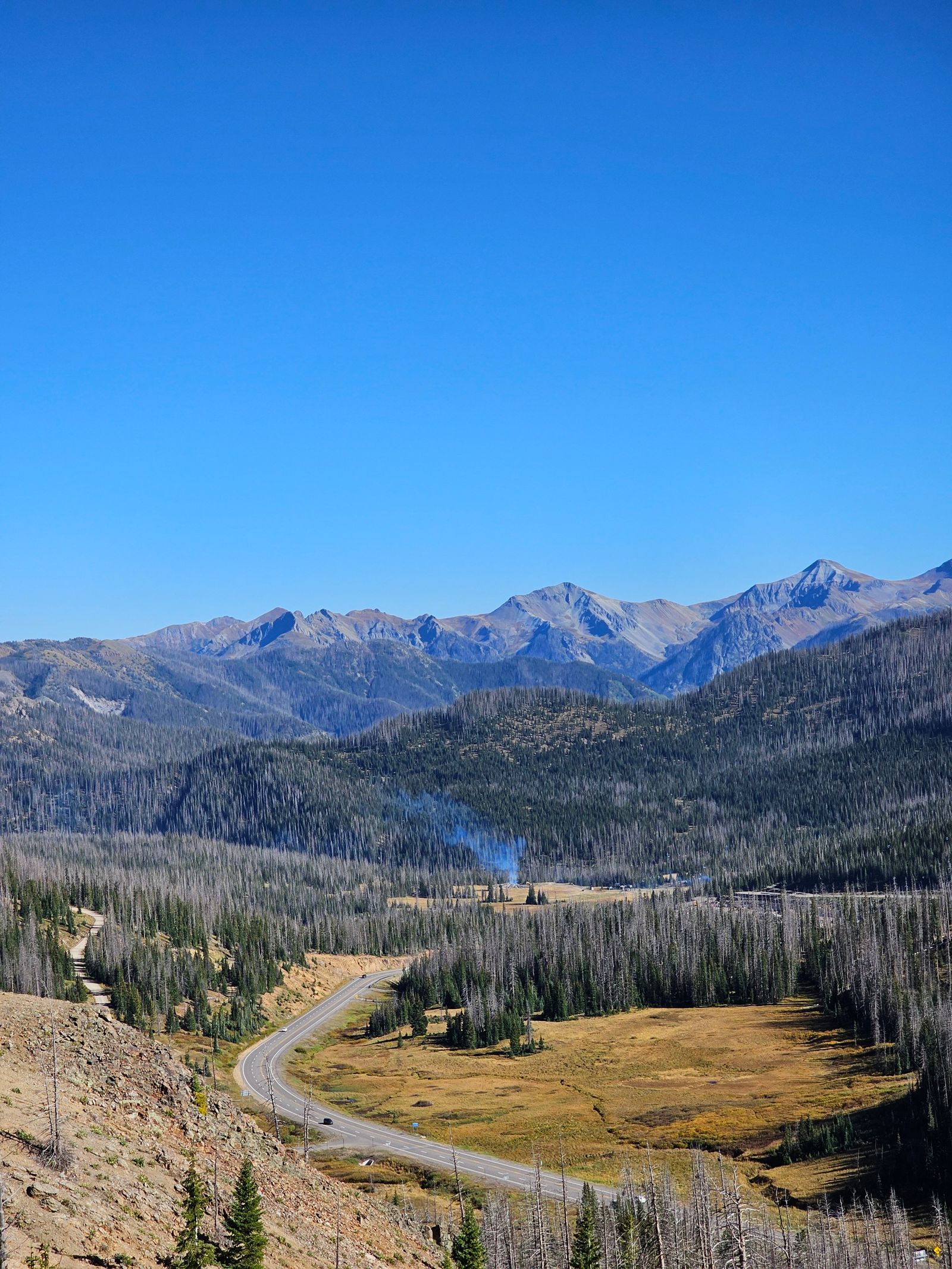
All drives involve US-550, the Million Dollar Highway, which is itself one of the most spectacular roads in North America -- carved into cliff faces above the Animas River gorge, winding over 11,000-foot passes with no guardrails and views that make passengers grip the dashboard. Consider it a bonus.
These lakes have been here for ten thousand years, and they'll outlast every photograph ever taken of them. But standing at the edge of one, watching the color shift as a cloud shadow crosses the basin, you understand why people keep climbing back up. The San Juans give you something that most mountain ranges don't: the feeling that you've walked into a place that hasn't quite decided to let humans visit yet, and you'd better appreciate it while you're here.
Ski Purgatory House sits about 30 to 45 minutes from the closest trailheads -- close enough to reach any of these lakes as a day trip, far enough down the mountain to sleep well at 8,793 feet after a long day above 12,000.
Ready to explore?
Plan Your San Juan Adventure
Stay at our luxury mountain townhouse and experience everything the San Juans have to offer.
Book Your Stay