San Juan Mountains · 8,000–13,000'
Hiking the San Juans
Alpine lakes, wildflower meadows, and 13,000-foot peaks — with trails that start right from the front door
Trail Guide
Four trails we love
The San Juan Mountains offer some of the most spectacular hiking in all of Colorado — from gentle meadow walks to lung-burning climbs above 12,000 feet. Here are four of our favorite trails, ranging from one that starts steps from the townhouse to the iconic turquoise lakes above Silverton.
A note on altitude: our townhouse sits at 8,793 feet, and several of these trails climb above 12,000 feet. If you're coming from sea level, give yourself a day or two to acclimate before tackling the harder hikes. Start with the Purgatory Trail or the meadow section of Coal Bank Pass, then work up to Ice Lakes.

Purgatory Trail
Walk out the front door
The trailhead sits right in the neighborhood — a short walk down the street from the townhouse. Purgatory Trail (#511) descends about 800 vertical feet over the first mile to the flats, then follows the contour of Cascade Creek for three miles to its confluence with the Animas River.
The terrain is wonderfully varied: a rocky initial descent, flat meadow hiking through Purgatory Flats, then a series of five up-and-down sections through old-growth forest before a final steep descent to the Animas River and the Animas River Bridge. Wildflowers, river views, and the chance to spot bears make this a quintessential San Juan experience.
Distance
8.6 miles
Elevation
1,656 ft
High Point
8,800 ft
Time
4–5 hours
Trailhead
Purgatory neighborhood
2-minute walk from the house
Best Season
June – October
Highlights

Ice Lakes & Island Lake
Colorado's most beautiful alpine lakes
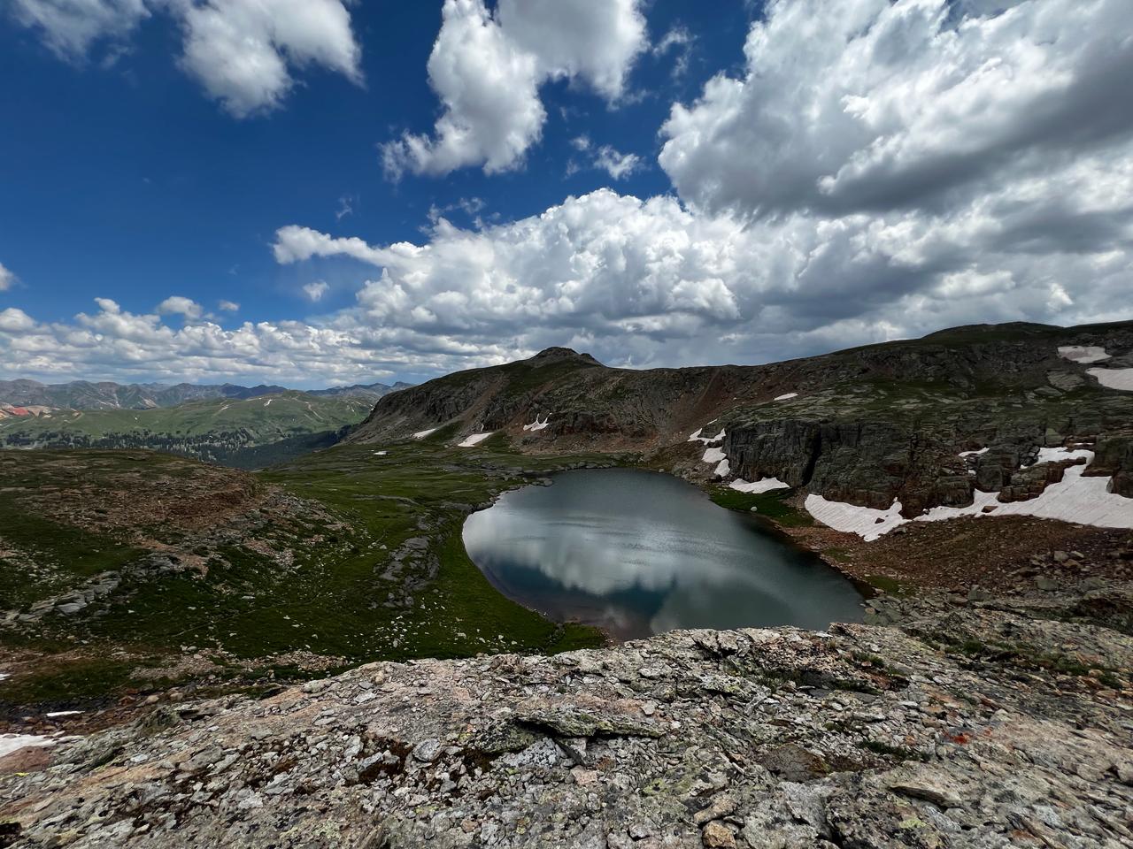
This is the premier hike out of Silverton and one of the most photographed trails in all of Colorado. The Ice Lakes Trail climbs relentlessly from the trailhead at 9,840 feet through dense forest, breaking above timberline into a lower basin of wildflower meadows before the final push to two of the most stunning alpine lakes in the Lower 48.
Ice Lake sits at 12,270 feet — a surreal, impossibly turquoise pool cradled beneath jagged 13,000-foot ridgelines. Continue another 0.7 miles to Island Lake at 12,392 feet for an even more dramatic setting, ringed by towering peaks reflected in crystal-clear waters. The colors of these lakes have to be seen to be believed.
Distance
8.4 miles
Elevation
2,550 ft
High Point
12,392 ft
Time
5–7 hours
Trailhead
South Mineral Campground
45 min from the house
Best Season
Mid-July – Mid-September
Highlights

Columbine Lake
Sapphire waters off the Million Dollar Highway
One of the most rewarding day hikes off the Million Dollar Highway, the Columbine Lake Trail (#509) climbs through 13 steep switchbacks before breaking above timberline into some of the most beautiful alpine terrain in the San Juans. The initial mile is demanding — gaining elevation rapidly from the trailhead at 10,340 feet — but the payoff is extraordinary.
At the two-mile mark, you reach a saddle at 12,448 feet where the grade softens and the trail becomes a pleasant walk into the upper basin of Mill Creek. The trail follows the creek to its source: Columbine Lake, a brilliantly sapphire-colored alpine pool at 12,693 feet. Brook trout fishing is good here, and strong hikers can continue to Columbine Pass at 13,094 feet for even bigger views.
Distance
6.6–8.2 miles
Elevation
2,540 ft
High Point
12,693 ft
Time
5–6 hours
Trailhead
Forest Road 820, off US-550
50 min from the house
Best Season
Mid-July – Mid-September
Highlights

Coal Bank Pass to Engineer Mountain
The best wildflower hike in the San Juans
Just up the road from the townhouse, Coal Bank Pass is the starting point for one of the finest wildflower hikes in all of Colorado. The trail climbs northeast from the pass through spruce-fir forest before emerging into expansive alpine meadows that explode with color from mid-July through August — columbines, paintbrush, lupine, and dozens more.
From the meadows, the trail steepens as it approaches Engineer Mountain, a dramatic 12,968-foot peak that towers above the surrounding landscape. The final push to the summit involves some Class 3 scrambling over rocky terrain, but you don't need to summit to have an incredible day — the meadow views alone are worth the trip. No fees, no registration, just wildflowers and big mountain scenery.
Distance
6.0 miles
Elevation
2,425 ft
High Point
12,968 ft
Time
4–6 hours
Trailhead
Coal Bank Pass, US-550
15 min from the house
Best Season
Mid-July – August (peak wildflowers)
Highlights
Before You Go
High-altitude hiking tips
Acclimate first
Give yourself a day or two at the townhouse (8,793 ft) before attempting trails above 12,000 ft. Hydrate well and take it easy.
Start early
Summer thunderstorms build by early afternoon, especially during monsoon season (July–August). Aim to be above treeline before noon and heading down by 1 PM.
Layer up
Temperatures can swing 40°F in a single hike. Bring a rain shell, warm layer, and sun protection — even on bluebird days.
Bear country
Black bears are common in the San Juans. Make noise on the trail, carry bear spray, and store food properly. Bears with cubs are often spotted on the Purgatory Trail.
Know your limits
If you feel symptoms of altitude sickness (headache, nausea, dizziness), descend immediately. Every trail here has beautiful scenery well before the high point.
Leave no trace
Alpine meadows are fragile and take decades to recover. Stay on trail, pack out all waste, and avoid trampling wildflowers for photos.