# The 10 Best Hikes Near Purgatory Resort (By Difficulty)
When you're staying at 8,793 feet in the San Juan Mountains, every trail offers something different. Some mornings you'll crave a gentle walk through aspen groves, while others call for the challenge of alpine peaks where Colorado's famous fourteeners pierce the sky. After exploring these mountains for years, I've learned that the best hiking guide isn't just about the most Instagram-worthy destinations—it's about matching the right trail to your energy, experience, and what you want to feel at the end of the day.
The area around Purgatory Resort sits in the heart of the San Juan National Forest, where mining history meets wilderness solitude. These aren't the crowded Front Range trails you've heard about. Here, you might encounter more elk than people, especially on the lesser-known routes that locals treasure.
Easy Trails (Perfect for Families & Recovery Days)
1. Hermosa Creek Trail (Lower Section)
Distance: 3-6 miles roundtrip (choose your turnaround) Elevation Gain: 200-400 feet Trailhead: 20 minutes north via Highway 550
This might be the most underrated easy hike in the area. The trail follows Hermosa Creek through a lush valley that feels more like Vermont than Colorado. In summer, the creek runs clear and cold—perfect for cooling off tired feet. The path is wide enough for side-by-side conversation, making it ideal for catching up with friends or introducing kids to mountain hiking.
What makes this special is the flexibility. Turn around at the first meadow (1.5 miles) for a gentle leg-stretcher, or continue to the old mining cabin remnants at three miles. The creek provides constant white noise, and in late summer, you'll find wild raspberries along the banks.
2. Animas River Trail (Durango Segment)
Distance: 4-7 miles roundtrip Elevation Gain: Minimal Trailhead: 25 minutes south in Durango
While technically not wilderness, this paved trail deserves mention because it connects you to the Animas River's story. Start at Memorial Park and follow the river north toward Trimble Hot Springs. The San Juan Mountains rise on both sides, and you'll understand why the Durango & Silverton Railroad chose this route over a century ago.
The trail passes through different ecosystems as you walk—riverside cottonwoods give way to scrub oak slopes. It's perfect for morning coffee walks or evening wind-downs when you want mountain views without the effort.
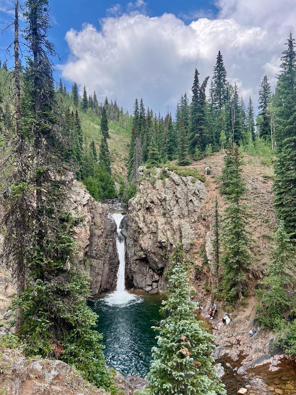
3. Cascade Creek Trail (Lower Portion)
Distance: 2-4 miles roundtrip Elevation Gain: 300 feet Trailhead: 15 minutes via Cascade Village Road
This trail starts right in Cascade Village and follows an old mining road through mixed conifer forest. The creek runs alongside most of the route, creating natural stopping points where kids can explore pools and look for trout fingerlings.
The trail gains elevation gradually, and you can extend it as far as energy allows. The first mile is the easiest, ending at a small waterfall that's particularly impressive during snowmelt season.
Moderate Trails (The Sweet Spot for Most Hikers)
4. Molas Lake & Little Molas Lake
Distance: 1-3 miles roundtrip Elevation Gain: 200 feet Trailhead: 20 minutes north on Highway 550
Don't let the short distance fool you—these alpine lakes pack serious visual punch. Molas Lake sits right off Highway 550, but Little Molas Lake requires a gentle climb through subalpine meadows that explode with wildflowers from mid-July through August.
The trail is short enough for a half-day adventure but scenic enough to occupy a full afternoon. Pack a lunch and find a boulder to sit on—the Needle Mountains dominate the southern horizon, and on clear days, you can pick out individual peaks on the Continental Divide.
5. Potato Lake (Spud Lake)
Distance: 4 miles roundtrip Elevation Gain: 800 feet Trailhead: 25 minutes via Lime Creek Road
This trail embodies everything great about San Juan hiking—it starts in dense forest, climbs through aspen groves that turn gold in September, and ends at an alpine lake surrounded by unnamed peaks. The name might not inspire confidence, but locals know this as one of the most reliable moderate hikes in the area.
The trail switchbacks steadily but never feels punishing. About halfway up, the forest opens to reveal your first glimpses of the surrounding peaks. The lake itself sits in a perfect cirque, and adventurous types can scramble up the talus slopes on the far side for even better views.
6. Haviland Lake Loop
Distance: 2.5 miles roundtrip Elevation Gain: 100 feet Trailhead: 15 minutes north on Highway 550
Sometimes the best hike is the one that surprises you. Haviland Lake's loop trail circumnavigates a peaceful mountain lake where you might spot great blue herons in the early morning. The trail stays relatively flat, winding through spruce and fir forest with occasional lake views.
What elevates this beyond a simple nature walk is the quality of solitude. While Ice Lakes Basin draws crowds, Haviland Lake remains quiet. It's perfect for shoulder season hiking when higher elevations still hold snow.
Challenging Trails (For Serious Mountain Days)
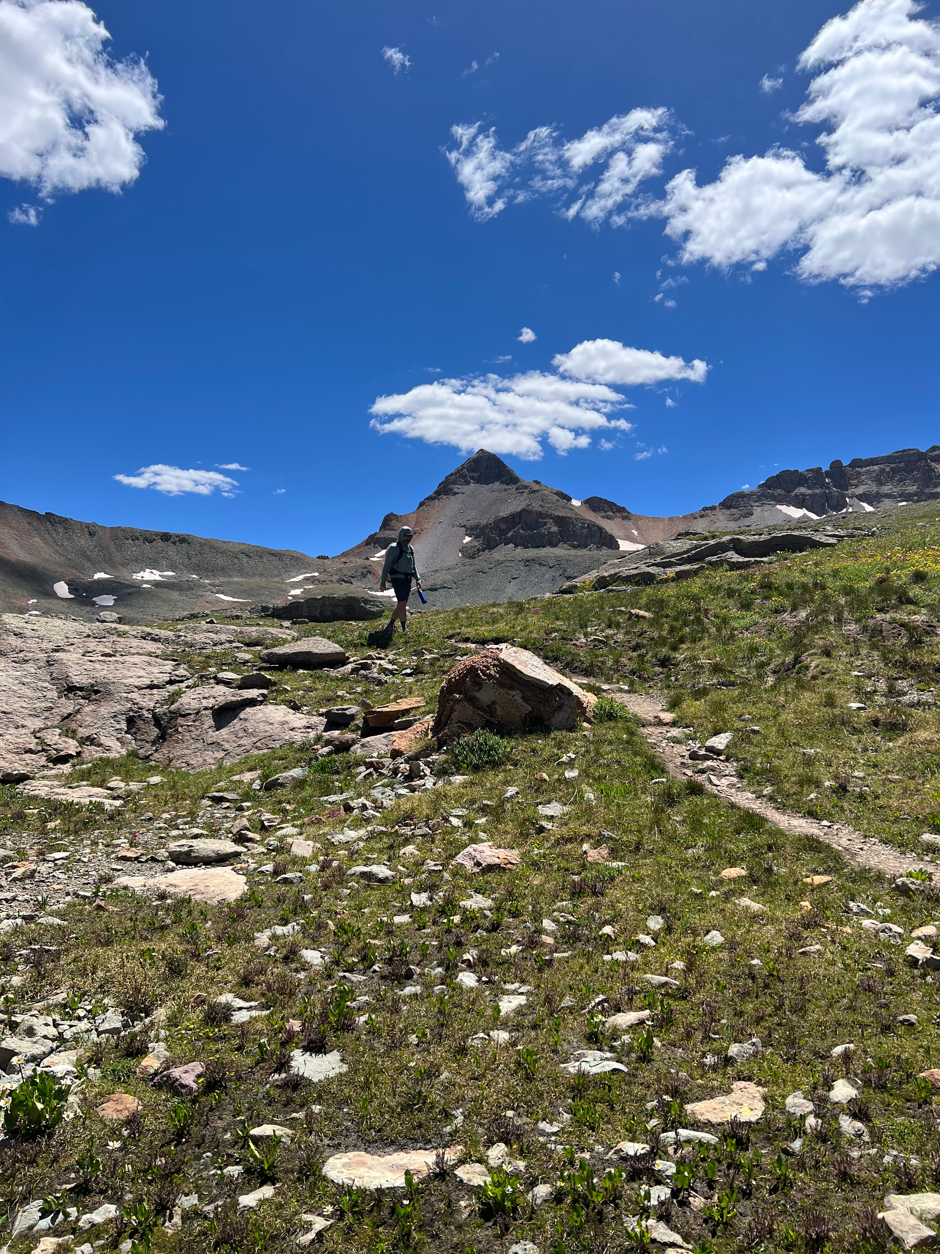
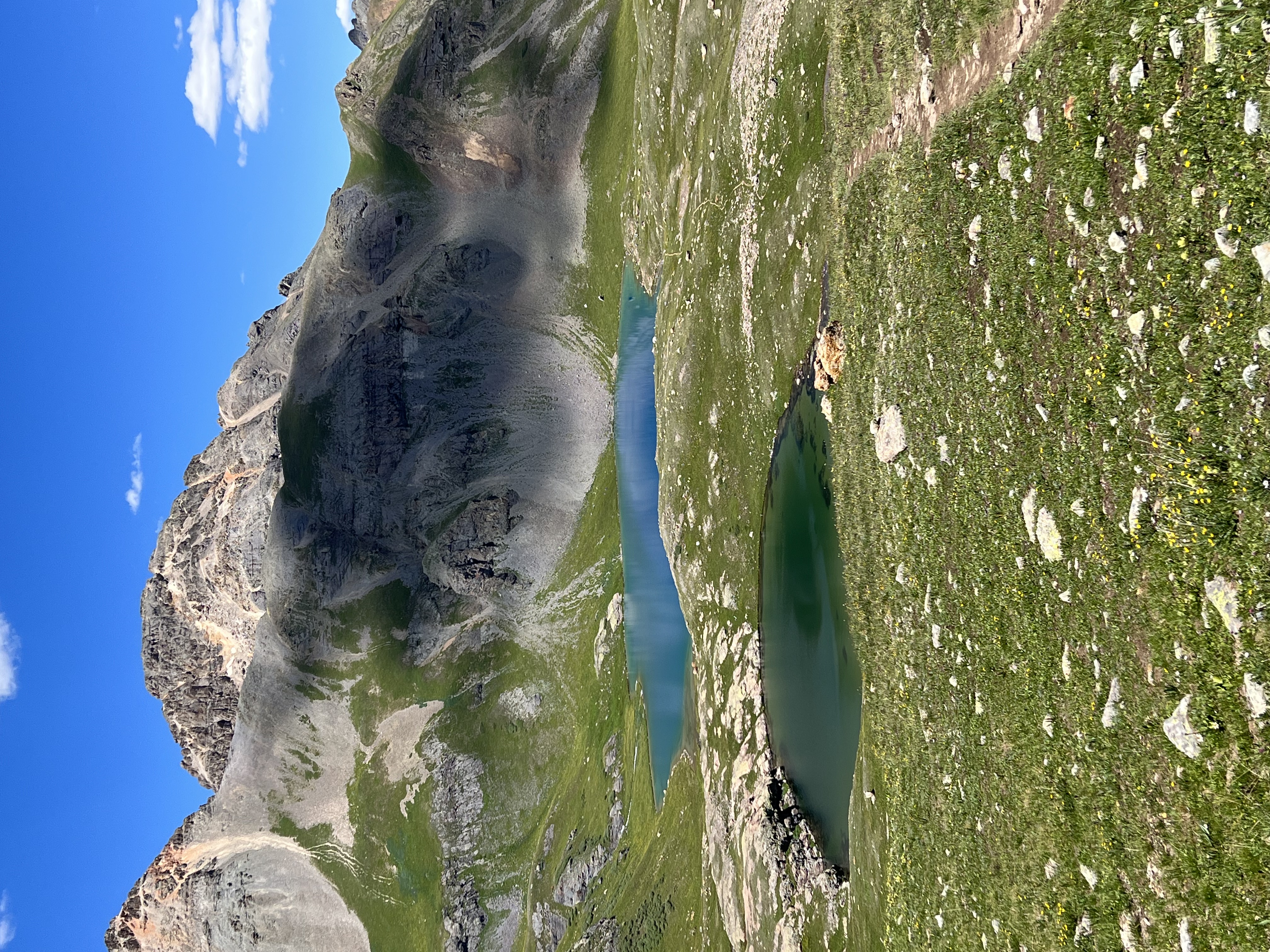
7. Ice Lakes Basin
Distance: 7 miles roundtrip Elevation Gain: 2,500 feet Trailhead: 30 minutes via South Mineral Road
This is the hike that appears on everyone's Colorado bucket list, and for good reason. Ice Lakes Basin showcases the San Juans at their most dramatic—turquoise alpine lakes, 13,000-foot peaks, and wildflower displays that can stop you in your tracks.
The trail starts innocuously through forest but quickly announces its intentions with relentless switchbacks. Around mile two, you'll break treeline and get your first taste of the alpine environment that makes this region special. The final approach to the lower lake feels like entering a natural cathedral.
Plan for a full day and start early—this trail attracts crowds during peak summer months. The reward is worth every step: Upper Ice Lake, accessible via a scramble from the main lake, offers even more spectacular views and considerably fewer people.
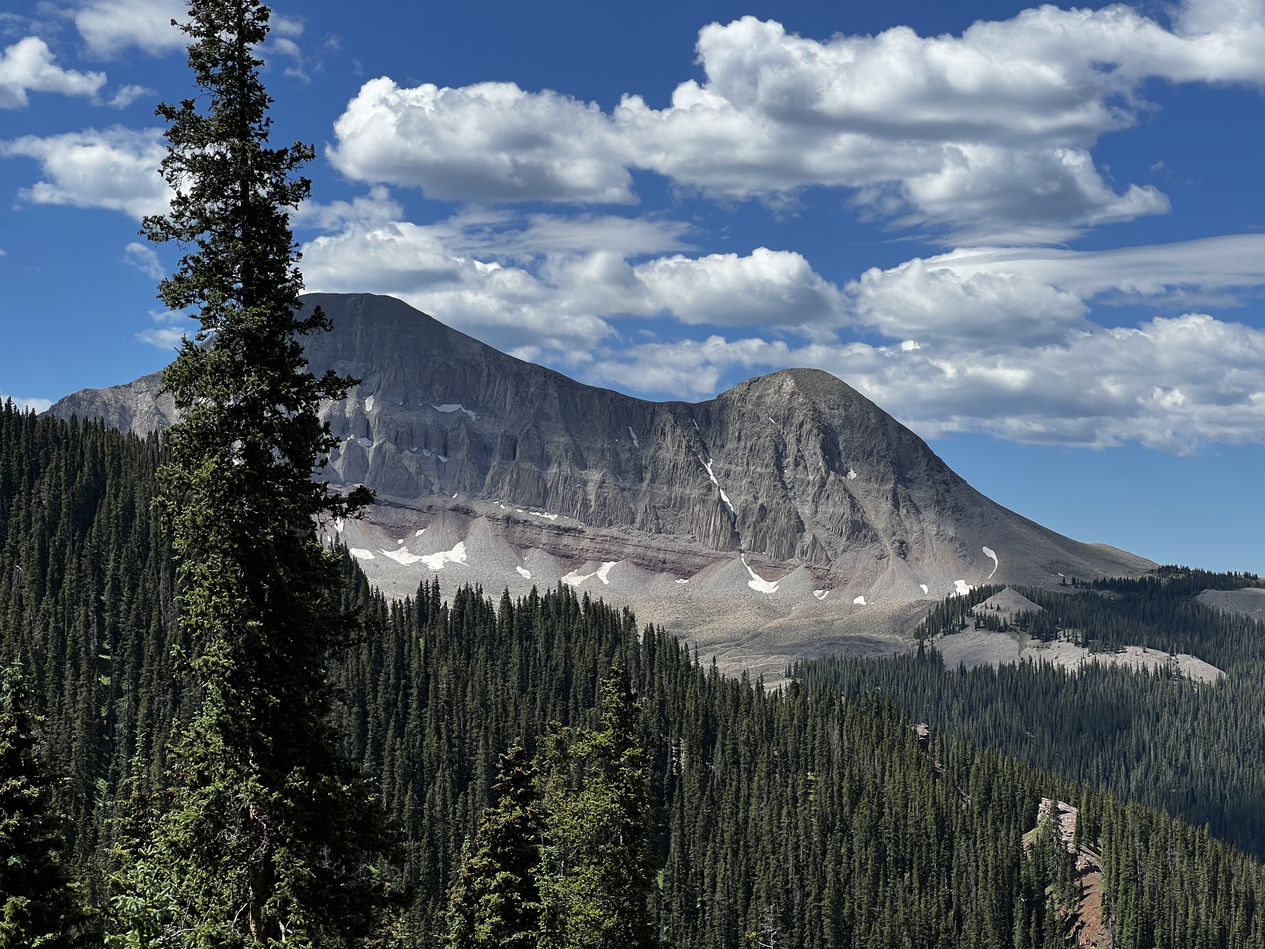
8. Engineer Mountain Trail
Distance: 8 miles roundtrip Elevation Gain: 3,000 feet Trailhead: 35 minutes via Engineer Pass Road (seasonal)
Engineer Mountain earned its name from the railroad surveyors who used it as a triangulation point, and climbing it gives you the same commanding perspective they sought. This isn't technically a fourteener—it tops out at 12,968 feet—but it feels every bit as substantial.
The trail follows an old mining road for the first few miles, making for steady but manageable climbing. Above treeline, the route becomes more adventurous, requiring basic scrambling skills for the final summit push. The 360-degree views from the top encompass the entire San Juan range, including distant glimpses of the Needles and the Weminuche Wilderness.
Expert Level (For Peak Baggers & Adventure Seekers)
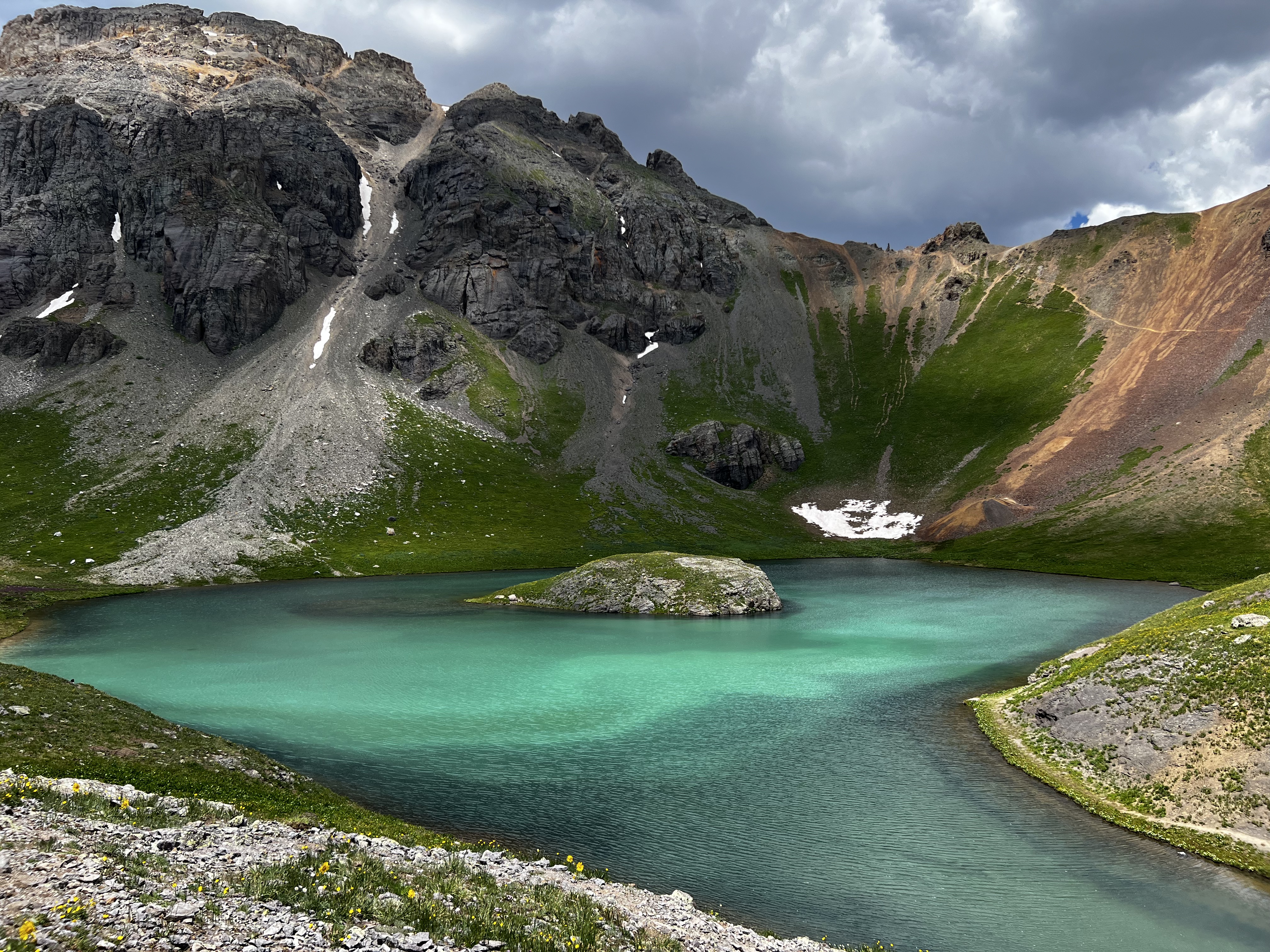
9. Bullion King Lake
Distance: 10 miles roundtrip Elevation Gain: 3,200 feet Trailhead: 45 minutes via Stony Pass Road (4WD required)
This trail separates casual hikers from mountain enthusiasts. Bullion King Lake sits in a remote cirque that requires commitment to reach, but the solitude and scenery justify every uphill step. The trail passes through classic San Juan terrain—mining ruins, alpine meadows, and finally the stark beauty of the high alpine zone.
Access requires a high-clearance 4WD vehicle, which keeps crowds minimal even during peak season. The lake itself sits at nearly 12,000 feet, surrounded by unnamed peaks that offer scrambling opportunities for those wanting to extend their adventure.
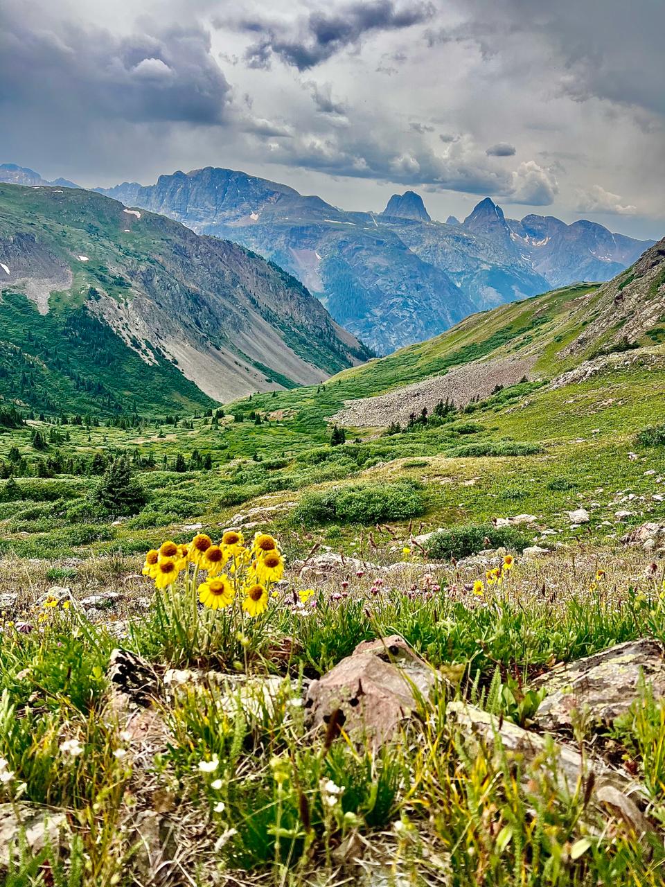
10. Continental Divide Trail (Molas Pass Section)
Distance: Variable (6-15+ miles) Elevation Gain: 1,500-4,000+ feet Trailhead: Molas Pass (25 minutes north)
The Continental Divide Trail offers unlimited possibilities for strong hikers. From Molas Pass, you can follow the CDT north toward Rolling Mountain or south toward the Weminuche Wilderness boundary. Either direction provides quintessential high-country hiking—expansive views, weather that can change in minutes, and the kind of solitude that reminds you why you came to the mountains.
This isn't a destination hike but rather a choose-your-own-adventure experience. Turn around when you've had enough, or continue as far as your legs and daylight allow. Just remember that weather above treeline can change rapidly, especially during monsoon season.
Planning Your Mountain Adventures
Best Hiking Months: Late June through September offer the most reliable trail access, though lower elevation trails like Hermosa Creek can be hiked year-round with proper preparation.
High Altitude Considerations: Even the "easy" trails here start above 8,000 feet. Drink extra water, move at a comfortable pace, and don't be surprised if you need more rest breaks than usual for the first few days.
Weather Reality: Mountain weather changes fast. Start early for alpine trails, carry layers, and always pack rain gear during monsoon season (mid-July through August).
Wildlife: Black bears are present but rarely seen. Make noise in thick forest sections, and never approach wildlife for photos. Elk are more common and equally deserving of respect and distance.
The beauty of staying near Purgatory Resort isn't just the convenient access to world-class skiing—it's having these diverse mountain experiences right outside your door. Whether you're nursing sore legs from a day on the slopes with a gentle creek walk, or pushing your limits on a challenging peak, the San Juan Mountains offer exactly the adventure you're seeking. After a day exploring these trails, there's nothing quite like returning to a warm mountain townhouse where the fireplace is ready and the mountain views continue long after your boots come off.
Ready to explore?
Plan Your San Juan Adventure
Stay at our luxury mountain townhouse and experience everything the San Juans have to offer.
Book Your Stay